Showing posts with label Johor Hiking. Show all posts

Saturday, September 27, 2025

Endau Rompin National Park Johor Adventure (Part 3)

4D3N Endau Rompin Adventure (Peta Entrance) from 20-23 Sept 2025 ... a fun and memorable adventure with water tubing activity, night walk, serious-stuff hiking, camping, river crossing, swimming at the cascades of Upeh Guling, taking boat ride and 4WD. Team members: KC Leong (organizer), Alice Siew, Ally Chong, Anita Mak, Iris Lee, Moon De Cerine, Gillian Ong, Sandra, Wey Tyng; Chan How Nean, Ernest Tang, Keong Wong, Ng Lay Keong, Tong San Hee. Chief Mountain Guide - Adil; Assistant Johor Mountain Guides - Syaiful and Ms Sue. Trip arranged by: Green Trekkers Sdn Bhd (details in the last image). Pejabat Pendaftaran Taman Negara Johor Endau Rompin (Peta), Kahang; For registration and also park your cars here overnight; click here for location. When the access road is ready, then one can drive all the way to the Visitors' Centre of the national park.
Do CLICK HERE for photos taken by yours truly, KC Leong.

The registration office in Kahang (after Kluang) is just a shoplot and we parked our cars for 4 days just in front of the shop. Anyway, it was a safe parking.
The chalets for overnight are just behind this sign post.
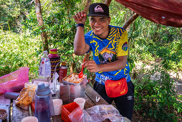
All meals are included in the package - Ally and Wey Tyng
Visitors' Centre chalets where we spent one night here before the hiking
Water tubing activity for one hour
This is how we transfer the camping stuff to campsite. The 4WD service is vital in the national park to ferry people from/to the various places for activities. Most of us hop on at the truck bed (back of 4WD) - Iris Lee
The Chief Mountain Guide, Adil, and the assistant guide, Syaiful (with spectacles), heard conflicting warning sound created by birds and monkeys from far and near. They suspected impending danger with the presence of tiger as this is their territory; so they set up fire and smoke to scare away any predators or spirit, if any. They are not using firecrackers method as they believe that the spirit would harm certain members of the orang asli community.

Another lesson learn: bring along a lighter when hiking big mountains.
Full Trans trails: tough triple ascent - Gillian Ong
Endau fan palm - uniquely and abundantly found only in this region. You have to be here to see this unique landscape - Iris Lee, Wey Tyng, Ally and Keong Wong.
Time to enjoy our packed lunch cooked by the Cooking Team
Janing Barat (543m) junction - an important junction where the Full Trans (a new and longer trail starts from Visitors' Centre) and the normal trail that starts from NERC (Nature Education and Research Centre) meet.

Ms Sue (left of photo frame) - another Johor Mountain Guide. She was leading the Full Trans team (longer route, tougher terrain).

Due to heavy rain in the late afternoon – on special consideration for safety – we were allowed to set up tents here for one night.
Kuala Jasin Campsite and Chalets area
All meals in the trek are provided - Ally, Anita, Wey Tyng, Gillian, Alice.
Tents rental is available at an affordable price (the two 3-man grey tents at the far end); You need to bring own sleeping bag, inflatable mattress and pillow. 
Start of journey (from Kuala Jasin Campsite) to Upeh Guling Waterfall
Passing by Kuala Marong Campsite - Iris Lee
The Chief Mountain Guide, Adil, was sharing his knowledge and experience with us while flanked by two leng lui - Gillian Ong and Ally Chong. The Endau Fan Palm, other than an icon or logo, can be used as a fan.
Strewn logs mess - swept along during a massive flood in March 2023 (journey to Upeh Guling Waterfall). It needs another flood to clear these logs away.
Upeh Guling cascades and waterfall, and the famed stone bathtubs
Upeh Guling cascades and waterfall, and the famed stone bathtubs - Ally and Iris
Upeh Guling cascades and waterfall - Sandra
A group photo before leaving Upeh Guling cascades and waterfall
Nice to complete the adventure with a sumptuous Chinese food.
新客栈Xin Ke Zhan Restaurant, Kluang (recommended by Felicia Hew whose hometown is in Kluang).

This photo is from Keong Wong.
Feel free to form hiker groups to enjoy this adventure. In my opinion, best group size is around 14 hikers as there is the economy of scale.


And before taking up the Endau Rompin challenge, one must train 'kaw kaw' at Mini Tahan (of Bukit Dinding, Kuala Lumpur).

At Kuala Jasin Campsite - the cooking crew are from Kampong Peta (Visitors' Centre). Distance apart = 8km. I think during normal days when there are no visitors, Kuala Jasin Campsite is devoid of people.

There are chalets at Kuala Jasin Campsite; one can consider not camping (thus reduce the amount of stuff to bring).

Posted by KC Leong

Wednesday, October 02, 2024

Johor Hiking Part 2 (Kluang)

Johor Hiking Part 2 (Kluang) from 28-30 Sept 2024 (Sat-Sun-Mon) ... covering Lata Tengkorak Waterfall, Trans Gunung Berlumut - Rimau, Trans Payong. 

Team members:

KC Leong, Amy Chan, Chan How Nean, Felicia Hew, Iris Lee, Jen Nee, Josephine Lee, Kellie Wong, Mei Chew, Rachel Thang, Rose Cheong, Sabrina Lim, TongSH, Vandy Yap, and Wey Tyng.

Mountain guide:  Apul +0116 386 6225

Do CLICK HERE to view 109 photos by KC Leong.

Day 1 hike to Lata Tengkorak Waterfall

Day 1: 

Lata Tengkorak waterfall and BBQ at Hutan Lipur Gunung Belumut.

Entering into the forest reserved areas of Johor
Lata Tengkorak Waterfall
Having fun and good time at the waterfall
Delicious BBQ fish and chicken prepared by mountain guide, Apul
Day 2 start of Gunung Berlumut and Gunung Rimau trans-peak hike

Day 2: 

Reversed trans Gunung Berlumut and Gunung Rimau

G. Berlumut elevation: 1,010m;

G. Rimau elevation: 889m;

Distance : 16km; 

Elevation gain: 1,600m;

Total duration: 10 hours.

The trails are wide and clear with the yellow-earth ground. A total of four sections or check-points (CP) to arrive at Gunung Berlumut peak. CP1 section is mostly flat and CP4 section is steep and difficult; with CP2 and CP3 sections gaining elevation gradually. 

Group photos with other team members and guides
An imposing view - At CP4 section, there is one area where we could see the peak of Gunung Chemendong. It take another 4 hours from Gunung Berlumut peak to this peak.
The terrain of CP4 section 
At CP4 rest-area, this is the only place along the trails where there is water source. Apul makes coffee and cooks instant noodles for all. Two thumbs up to Apul !
The peak of Gunung Berlumut ... Rachel Thang with Apul's 10-year-old son who hiked with us swiftly until the other peak (Gunung Rimau).
Gunung Rimau peak - from the peak of Gunung Berlumut, it takes another 1 hr 30 min to arrive here; to return to G. Berlumut peak, another 1 hr 30 min. The V-shape terrain is steep.
Mist and sunbeam - During Day 2 of Gunung Berlumut-Rimau hike, heavy rain started at 2:45pm. At that time, Mei Chew and I were at CP4 section, still have about one-third of the CP4 distance to descend. This section is steep and steps are wide, also requires both hands to hold on to the ropes. With the mud water gushing down the same trail blocking the view for proper landing ground, it was indeed a tough challenge. After about one hour in the rain, at around 4pm at CP1 section, we saw the rays of sunlight shined through the foliage and the mist.
Day 3 - start of Trans Payong hike 

Day 3:

Trans Payung at Parit Sulong

(Bukit Botak, Bukit Berdiri, Bukit Payong)

Distance : 5km;

Total duration: 4 hours.

Moss growing on rocks that gives a rusty-orange appearance
(Left) Rose Choeng, Vandy Yap, Felicia Hew, Josephine Lee, Jen Nee
Rachel Thang and Jen Nee
Kellie Wong and Amy Chan
A final group photo at Bukit Payong
Late lunch in Muar town at 4pm. 

Do Click Here to view photos of Johor Hiking Part 1 (Kota Tinggi) from 10-12 June 2023. 

Kluang famous tau sar peah (豆沙饼) - the team ordered a total of 70 packets of the pastry from Tong Huat's Confectionary as take-home souvenir with the help of Felicia Hew whose hometown is from Kluang.

Posted by KC Leong

Thursday, June 15, 2023

Johor Hiking 2023

Johor hiking from 10 to 12 June 2023 (Sat-Sun-Mon) covering Gunung Pulai (Day 1), Trans Panti (Day 2) and Gunung Lambak (Day 3 at Kluang).

Round trip timing: G. Pulai = 6 hr; Trans Panti = 7 hr 30 min; G. Lambak = 4 hr. 

Do CLICK HERE to view photos courtesy of yours truly, KC Leong.

At the start of Gunung Pulai hike

Team members: KC Leong, Chan How Nean, ChongYF, Derrick Tan, Ng LK, Josephine Lee, Mey Wong, Pearly Tan, Rynn, Sabrina Lim, Iris Lee, Wey Tyng, Carrin Kan, Swee Khim.

Gunung Pulai – the peak is a Telekom transmission tower; certain part of the trails is walking by the side of a stream; there are a few waterfalls on the descent journey.
Batu Katak
The group needs to descend this waterfall with the help of ropes
Looking up from the pool below
Another waterfall for this Gunung Pulai hike
Start of Trans Panti from the East

Trans Panti – we took 2 hr 30 min to arrive at the trail head (east) that involved driving our cars and taking the specially arranged 4WD. Traversing from east, to middle and then to the west, this trail would lead one to the Transformer Rock. After 5 hours of hike, we arrived at a nice rest area – complete with tables and benches – overlooking other mountains. The descent journey involved a near vertical drop in abseiling style. The trail head (west) is where Care Haven orphanage home is located where we parked our cars and took bath there.
The famous Transformer Rocks
Apul - the mountain guide from Johor

Mountain guide from Johor – Encik Apul (011-6386 6225) ... he is a good guide in ensuring the safety of all team members; he speaks fluent English; he also boiled water for making hot drinks; for those who are hungry, he even cooked Maggi mee.
A nice rest area up in the mountains (nearer to the west trailhead)
A near vertical rock of almost 50 meters in height
The Care Haven orphanage home at the trailhead of west trail (we parked our cars and took bath after the hike here)
Start of Gunung Lambak at Kluang

Gunung Lambak (Kluang) – this trail is a good exercising ground with the locals with wide and clear paths. The lower parts of the trail are running parallel with a stream with clear water. The peak of the hill is also a Telekom transmission tower. The original plan was to hike Pelepeh Kiri and waterfall (near Gunung Panti) but that venue was closed for maintenance.

At the peak of Gunung Lambak
A stream with cascades of clear water 

Do CLICK HERE for Part 2 (KLUANG).

Posted by KC Leong.