Sunday, July 06, 2025

Mini Tahan of Bukit Dinding Hike

Bukit Dinding Hike

Saturday, 5 July 2025

Distance: 10km;

Elevation gain: 721m;

Total time: about 6 hours.

(Data from Strava)

CLICK HERE for WikiLoc trailmap of KL See See and Kazumi Otai trails.

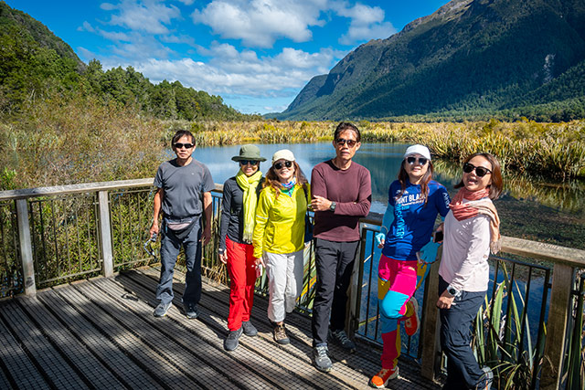
Photos below: click on the image for actual bigger file size display. (Photos courtesy of ChanHN, Helen Khoo).

Group photo at the trailhead

After completing the challenging hike of Mini Tahan trails, the team emerged at a junction of a tar road for refreshment break. This tar road leads one to the peak. After that, we walked to the peak for photos shoot. 

We entered the KL See See (for KLCC) trail to return to carpark. We passed by the first view point: City View Look-out Point. The trails are well-marked; we just followed the pink markers.

Mini Tahan trail is with steep uphill and downhill slopes

We arrived at another viewpoint: Setiawangsa Viewpoint. Here, there are tables and chairs for resting or enjoying the nice view of the city skyline. After that, we followed the orange markers for Kazumi Otai trails. Returning to carpark via this trail is challenging: other than the steep descent, there are a few steep ascents. Imagine when one is already tired, one still has to hike up a few steep slopes.

The iconic tree of this Mini Tahan trail

This combination of trails – Mini Tahan, KL See See, Kazumi Otai – is excellent for tough training, even better than Bukit Kiara or Apek Hill. The Mini Tahan trails are not suitable for beginner hikers - tough and technical. There were two mobile drinks stations selling drinks. If the elevation gain is still not sufficient, one can always do another reversed loop. 😀 

Having refreshment break after emerging from the Mini Tahan trail. The tar road leads one to the peak of Bukit Dinding
In high spirit
We enter this trail to return to carpark ... homonyms: KL See See = KLCC Building
The first look-out viewpoint
The second look-out viewpoint - Setiawangsa Viewpoint
Kazumi Otai Trail - with steep slopes
Descending the challenging rock face 
Yeah, we did it !!Compare Blue Trail and the KL See See Trail and Kazumi Otai Trail

When we were hiking Mini Tahan trails, at one point, we would see the convergence with Purple Trail. From the trail map, the Purple Trail starts from the other trail head (where vehicles can follow the tar road to the peak).

Posted by KC Leong

Sunday, April 06, 2025

New Zealand Hiking and Sightseeing - Part 4

This is the 4th and final posting of New Zealand (South Island) 16D14N hiking and sightseeing trip from 2-17 March 2025 ... This photo album contains photos for following activities:

(a) Moeraki Boulders Beach;
(b) The Octagon of Dunedin; visit Dunedin Railway Station;
(c) next morning, hike Sandfly Beach and Sandymount Hill Track with diverse scenery of beaches and sand dunes; we ate lunch by the beach just 30 meters from the sun-bathing sea lions (Google Maps: Sandfly Bay).

Do CLICK HERE for photos taken by yours truly, KC Leong, using a Nikon mirrorless camera.
Moeraki Boulders Beach with the unique round boulders

(d) Balwin Street of Dunedin - World's Steepest Street;
(e) Dunedin Botanic Garden;
(f) Check-in to hostel at Te Anau;
(g) Drive to Milford Sound - Mirror Lakes (Milford Sound is 2 hours' drive from Te Anau).
(h) The Routeburn Track;
(i) Lake Marian waterfall;

Otago Daily Times building - on the way to the railway station of Dunedin

(j) Continue journey to Milford Sound cruise terminal (closed at 5pm; we arrived at 5:30pm; last cruise is at 3pm; NZ$160 per pax for cruise);
(k) Vibrant sunrise the next morning at Te Anau;
(l) Hiking Kepler Track at Te Anau (due to lack of time, we end the hike at Brod Bay).

Dunedin Railway Station

We then drove back to Queenstown, have Fergburger each for dinner (no cooking for the final evening); overnight at the same hostel. 

At 5am on 17 March 2025, we drove to Queenstown airport, returned the awesome Kia Carnival, and took the 7:00am flight back to Kuala Lumpur. 

With that, we completed the 16-day memorable hiking and sightseeing journey in South Island of New Zealand. 

Dunedin Railway Station
Hike Sandfly Beach and Sandymount Hill Track
We have our lunch at the beach; time is around 1:30pm
Just 30 meters from the sun-bathing sea lions (Google Maps: Sandfly Bay).
Balwin Street of Dunedin - World's Steepest Street
Balwin Street of Dunedin - at the top of the World's Steepest Street
Dunedin Botanic Garden - having our tea with the the jagong that we boiled in the morning
Check-in to hostel at Te Anau - fronting Lake Te Anau
The hostel at Te Anau
Eglinton Valley
Mirror Lakes
The Routeburn Track
Lake Marian waterfall
Vibrant sunrise the next morning at Te Anau
Hiking Kepler Track at Te Anau
Due to lack of time, we end the hike at Brod Bay of Kepler Track

Do CLICK HERE to view Part 1

Do CLICK HERE to view Part 3.

Posted by KC Leong

Saturday, April 05, 2025

New Zealand Hiking and Sightseeing - Part 3

New Zealand (South Island) 16D14N hiking and sightseeing trip from 2-17 March 2025 ... 

This photo album contains photos of following activities:

(a) The scenic Lake Pukaki (leaving Aoraki/Mount Cook to Lake Tekapo);
(b) The iconic Church of Lake Tekapo;
(c) Hike Mount John overlooking Lake Tekapo;
(d) Hostel dining area with a view to Lake Tekapo; and spectacular sunrise the next morning;
(e) Travel from Lake Tekapo to Christchurch;
(f) Visit Botanic Garden of Christchurch;
(g) Next day (12 March 2025) bad weather the whole day: not able to hike Bridle Path Trail next to the Gondola Lower Station; instead, taking shelter there;
(h) Oamaru Blue Penguin Colony (leaving from Christchurch to Dunedin).

Do CLICK HERE for photos taken by yours truly, KC Leong, using a Nikon mirrorless camera.

The scenic Lake Pukaki Lookout
The scenic Lake Pukaki Viewpoint
Walk from hostel to the iconic Church of Lake Tekapo, about 500 meters away
The iconic Church of Lake Tekapo
Hike Mount John overlooking Lake Tekapo; University of Canterbury Mt John Observatory in the background
Hike Mount John overlooking Lake Tekapo ... Josephine Lee
Hostel dining area with a view to Lake Tekapo
Spectacular sunrise the next morning ... Vandy Yap
Spectacular sunrise the next morning at Lake Tekapo
Three Creeks, Vintage Garage Decor (travel from Lake Tekapo to Christchurch)
Fairlie Basin Lookout
Botanic Garden of Christchurch
Oamaru Blue Penguin Colony (leaving from Christchurch to Dunedin)


Do click here for Part 4.

Do click here for Part 2.

Posted by KC Leong