Monday, July 30, 2018

CULTRA 2018

The Cameron Ultra-trail (CULTRA) race started at 6:15 a.m. as planned on Saturday 28 July 2018 for the 30km category that I took park. After the first kilometre run on tar road passing by Tanah Rata main road, all runners were directed into the trails. While waiting in darkness at the narrow trail trying to clear the queue, I could see the strings of light going up the hills illuminated from runners' headlamps. 

Do CLICK HERE to view photos courtesy of yours truly, KC Leong. In the photo album, click "i" (info) for the descriptions of each photo.

Vibrant sunset viewed from Greenhill Resort Apartment, Tanah Rata where we have a comfortable and pleasant stay for 3D2N; it is only 600 meters to the starting line.

Looking up the hills, the terrain was similar to hiking trails – steep slope and with lots of roots on the ground. The running trails in this event were actually trails meant for hiking, and not the rolling hills type. True to the elevation map, the Jasar and Berembun peaks were tough hills to overcome, plus two smaller peaks after Sam Poh Temple; hence, the tagline of the event – Be prepared, be very prepare! The most satisfying moment was descending from the Berumbun peak where at certain stretches, it was run-able going downhill. With the hiking skill, I picked up the momentum and overtook almost 30 trail runners. 

Yours truly crossing the finishing line in 7hr 12 min, another 48 min to cut-off time
With ChongYF, the running buddy

At check-point #3 and after passing by Robinson waterfall, all runners maneuvered down a steep slope. I saw a young lady (three runners in front of me) slipped and pitched forward, tumbling down the slope almost 10 feet below the trail. Luckily, her group of male runner friends where there to lend their helping hands. Another tough moment was to arrive at check-point #4 where the runners have to run uphill on tar road all the way to Boh Heritage Tea Centre and Factory at Habu. 

Sunday 29 July, 8am having breakfast at Tanah Rata cheering 100km runners dashing to the finishing line

Overall, it was a good trail running event amidst the fresh and cool mountainous air of Cameron Highlands. The organizing standard of the organizer was good and is almost on par with other international trail running events. 

Trophies and sports products/vouchers for the podium finishers

What I like:

a. well-organized event (dissemination of information via online and internet, systematic collection of race packs, big number of volunteers);

b. clear signage showing the direction with volunteers stationed at critical junctions (even camping in the jungle);

c. water stations with ample supply of drinking water, isotonic drinks, hot tea, oranges and dates; certain critical check-points even provided porridge.

The trail runners and supporter

Areas for Improvement:

a. after the first kilometre run on tar road, all runners were directed to narrow hiking trails; most runners would have wasted valuable time waiting to clear the queue;

b. at one tar road T-junction after emerging from Berumpun peak (just before check-point #3), the signage showed: 15km with an arrow going straight. Then what happened to the other categories, turning right? (we found out later that turning right was the wrong way)

Prize giving ceremony and the cheering crowd

c. with the tremendous enthusiasm from runners trying to register in this event but the window for registration was closed permanently after 15 minutes, many of the trail runners were not able to participate. The organizer may look at increasing the number of participants or a systematic way in selecting the participants.

Posted by KC Leong

Monday, July 23, 2018

Pine Tree Trail Hike

Hiking Pine Tree Trail and overnight at High Pines Bungalow in Fraser's Hill from 20-22 July 2018 ... July is a dry and hot month in Klang Valley; as such, staging a 3D2N stay in the cool mountains and hiking Pine Tree Trail was an excellent idea. 

Do CLICK HERE to view photos courtesy of yours truly, KC Leong.
 Looking for tarantula spiders ... one of the tarantula species is found only at this hill resorts and nowhere else in the world


That was my first time staying in High Pines Bungalow, a cosy greystone bungalow owned by Boh Plantations group. This lovely Scottish design bungalow sits at one of the highest spots in Fraser's Hill with good views of the surrounding mountains, and is frequently engulfed in low clouds. The best part is that it is only a stone's throw away from the trail head of Pine Tree Trail.
 Relax after dinner in High Pines Bungalow with good hiking company


As usual, many hikers felt that the returning journey of Pine Tree Trail hike was also tiring as the terrain was not all downhill descent. One still has to climb two major flights of stairs and a final uphill hike to return to the trail head.

Timing:
Start hiking = 7:30 a.m.
One way to the first peak = 2.5 hr to 3 hr;
First peak to 2nd peak = 30 to 45 min;
Round trip is about 7 hours.
A cool and misty morning at High Pines Bungalow


High Pines Bungalow (Fraser's Hill) ... It was a coincidence that the caretaker, Mr Tan, was admitted to hospital. The wife who does not cook, was in-charged.  Most of the group members opined that his wife was too petty, nasty and giving us a hard time (that affected the mood of the stay) even though we paid for the 3D2N accommodation: she was overly concern that we must not dirty the place; that we could not use the crockery (not even the cups!!); that we could not boil water for drinking; that we must not bring food and consume in the bungalow; that we could not do this or that, etc. Suggesting that we should eat our food in the garden, she said but subject to the gardener's permission. But a check at the garden, there was no table and chairs to put the food. We wonder who set the rules!

A group member commented that with years taking charge of the bungalow/property, they felt that visitors are encroaching into their territory; hence, imposing rules that disregard even basic needs.
 At the front gate of High Pines Bungalow ... I have been hiking at Pine Tree Trail for almost 10 times but I have never cross this boundary. 
(back, left) LooHinLee, Jimmy Teh, Angie Ng, Jackie, Rocky Chan, Irene Poh, Sally Teh, Abdullah, Julia Ooi, Karen Lee, LeeWaiYin; (front) KC Leong, ChanHN, Loo Hin Lee, ChinYM (holding camera: Freddy Yeong)
 A group photo at the trail head of Pine Tree Trail ... the metal signage is a new one (not sure why there is a need for two); notice the gate at the left of the photo frame – that is the High Pines Bungalow. It was also the first time that we do not need to drive to the trail head.
 A bigger group photo at the first peak with members from another two hiking groups
 View from the second peak ... that is the trail leading to the Semangok Peak: two hours to Merah Campsite, and another 4 hours to the peak. In the photo: Eddie Lau, Jessica Tan, Julia Ooi
 Group photo at the second peak
 Ascending and descending this part of the hill is dangerous ... posing for photo is Eva Chin
 Day 3 camping-style breakfast at a pondok en route to Jeriau Waterfall
At Jeriau Waterfall
(click above trail map for actual bigger size)
At the entrance of Jeriau Waterfall, we met six trail runners who ran/hiked from the Pine Tree trail head and returned via another run-able trail that connected to this Jeriau Waterfall (light-blue line above). Does anyone know this new trail, do kindly share information. We are having plan to explore this trail. This shorter or slightly easier trail would enable the day hike to Semangkok Peak be completed within daytime.

Posted by KC Leong

Wednesday, July 11, 2018

Kundasang Holiday

Together with Zhineng qigong members and friends, we went for a 5D4N holiday trip to the cool mountains of Kundasang (Kota Kinabalu), and the white sandy beaches of Manukan and Sapi Islands from 6 to 10 July 2018. We stayed two nights in Kundasang and two nights in Kota Kinabalu. Excluding Air Asia flight tickets, total amount spent for food, accommodation and transport was RM900 per person.

While overnight at DreamWorld Resort, the wind was blowing strongly the whole night. A few of the team members could not sleep well due to the rattling sound of the glass-panel door. I tried leaving a 1cm gap between the two glass-panel door, and that produced howling sound. According to a member of DreamWorld Resort staff, July and August would experience strong wind in Kundasang. 

Do CLICK HERE to view photos courtesy of yours truly, KC Leong.

 DreamWorld Resort ... good view overlooking the Kundasang town


At the jetty for islands hopping (Manukan Island, Sapi Island, etc), there were many Chinese and Korean tourists – a good sign for the Sabah tourism industry. At the Philippines night market, 1kg of mangosteen sells for RM35, and 1kg of mango sells for RM25 – almost four times the price as in Kuala Lumpur.

Overall it was a nice and pleasant short holidays where one experiences "from the mountain base (not 'top') to the ocean beach (not 'deep')". If you would like to go, I can provide good information to you.
 Visiting Desa Dairy Farm which is very near to DreamWorld Resorts
 Visiting Sabah Tea Plantation ... background is Mount Kinabalu; this establishment is much smaller than the Boh Plantation in Cameron Highlands
 Poring Hotspring
 Overnight at the cosy H. Benjamin Residence Hotel ... background is the back view of Mount Kinabalu
 A tour of Kinabalu National Park
 Viewing sunset at Tanjung Aru Beach ... the huge food-court has been demolished
 Enjoying the delicious and sumptuous seafood dinner in Kota Kinabalu 
 Islands hopping at Manukan and Sapi islands ... lunch at Manukan Island is RM40 to RM60 per pax; for big group, advance notice is required as food is brought from main land.
Mari Mari Cultural Village tour and performance; entrance fee includes lunch ... recommended place to visit when one is in Kota Kinabalu

Posted by KC Leong


Monday, July 02, 2018

Bukit Kledang Hike Part 1

Hiking Kledang Hill at Menglembu, Ipoh ... We started our journey excitedly from Kuala Lumpur on Saturday 30 June 2018 at 7:30 a.m. En route to Ipoh, we stopped at Lata Kinjang waterfall of Tapah for photos shoot. After having lunch at Kong Heng coffeeshop in Ipoh, we walked around Concubine Lane. We later checked-in at MC Homestay in Menglembu; free-and-easy in preparing for the hike the following morning. 

Do CLICK HERE to view photos courtesy of yours truly, KC Leong.

 Photos shoot at Lata Kinjang waterfall, Tapah


 (left) KC Leong, Karen, Lana, Kellie, Bee, Shu-Lin, Hooi Miin, Ivy Wong, LeeWY; 
(front) ChongYF, George Siew.
 Behind Ipoh Kong Heng coffeeshop area
 At Concubine Lane
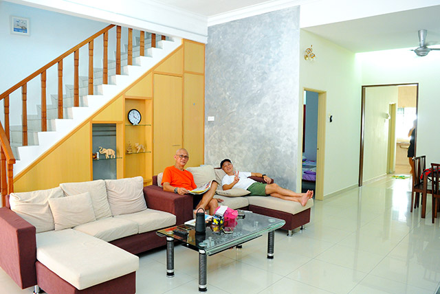
 The spacious master bedroom

About MC Homestay in Menglembu: This homestay is clean and can sleep 16 persons comfortably; it has four rooms each with attached bathroom. Located in a quiet housing area, it is only 2.3km to the Kledang Hill trailhead. The shared accommodation cost is very reasonable for each person. Google Maps search key: MC Homestay - Taman Kledang Permai. Contact person: Matthew Chin - 012 561 0231
 The main hall of MC Homestay
Sumptuous dinner at Menglembu ... with big portion serving

Do CLICK HERE for Part 2 ... hiking up Kledang Hill.

Posted by KC Leong

Bukit Kledang Hike Part 2

After a dim sum breakfast at Menglembu town, we arrived at the Kledang Hill trailhead at 7:30 a.m. on Sunday, 1 July 2018. Parking at the car park was full to the brim, and we have to park our cars at the housing area. The Team Lead for the hike were June and Tiger Chee. Accompanying us was June's adorable labrador dog, Baileys. Whenever Baileys saw any pool, it would jump into the water to cool itself. And it was such a joy seeing Baileys playing in the water. Special thanks to ChanHN in arranging for Team Leads and good food in Menglembu and Ipoh.

Do CLICK HERE to view photos courtesy of yours truly, KC Leong.

 Group photo at trailhead

Our target was to arrive at the peak where RTM transmission towers were located. All the trails are labelled with the unique numbers and not names (for example Ah Meng trail). We followed Trail 5.4 and then Trail 5.8 or RTM Trail to the peak.

The first part of the trails was fairly flat running in a criss-cross pattern with the streams. After the stream area, the terrain was going uphill and steeper terrain all the way to the peak. Standing at 808m or 2651 feet, one way to the peak is around 2hr 15 min. 

 Baileys enjoying itself in the water

With 30 minutes rest at the peak, we descended the hill via tar road. After 30 minutes, we entered the trails again via Trail 5.4 passing by a giant tree. Round trip was about 5 hours with time spent on photos shoot. By the time we returned to the trailhead car park, the car park was almost empty. I was told that most locals or the regulars would not hike for such long hours.
The trails there are pleasant to hike; difficulty level is probably a few times more difficult than Apek Hill Cheras in Kuala Lumpur.

 The trails are labelled with numbers and not names

About Kledang Hill trailhead: Google Maps search key: Kledang Hill Trail Head
GPS coordinates: 4°34'35.4"N 101°01'48.8"E
                         4.576493, 101.030220

 RTM transmission towers
 The Team Leads: Tiger Chee, June and Baileys
 Group photo at the peak with an elevation of 808m
 Trail 5.4 passing by a giant tree
Nice view ... Shu-Lin, Lana and Hooi Miin
Special thanks to ChanHN in arranging for Team Leads and good food ... (left) Agnes, ChanHN, Angie, Kim Thai, WongYF

Do CLICK HERE for Part 1 (the journey to Ipoh, Lata Kinjang waterfall and staying in homestay at Menglembu)

Posted by KC LEONG