Being a Malaysian, one must try hiking up Mount Kinabalu – because it is there. Likewise, if one has the enthusiasm, one must challenge oneself by hiking up Gunung Tahan. Standing at an elevation of 2,187 meters, it is the highest peak in Peninsular Msia, or G1 of the G7 mountains. This mountain is considered by many to be one of the toughest treks in Peninsular Msia. From Merapoh side, one has to cross a total of 8 streams/rivers, climb steep rooted paths, step on muddy puddle to arrive at the destination.
Do CLICK HERE to view 220 high-resolution photos courtesy of your truly, KC ... in this photo album, it also contains photos contributed from the team members.
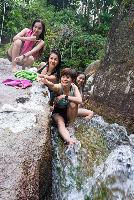
Declaration of personal items at Sungai Relau Park Office ... Shu-Lin, KC, Sabrina.
Gunung Tahan trip from 28 May to 2 June 2022 (6D5N) itinerary
Day 1 - drive to Merapoh; overnight in a hostel;
Day 2 - declaration of personal items at Sungai Relau Park Office; 4WD transfer to Kuala Juram trailhead; camping at Kem Kor (750m);
Day 3 - camping at Kem Kubang (1,406m);
Day 4 (31 May) - arrive at Kem Botak (1,943m); ascent to summit; viewing sunset; camping at Kem Botak;
Day 5 - descent from Kem Botak to Kem Kor; final camping at Kem Kor;
Day 6 - return to Kuala Juram trailhead; 4WD transfer to Sg Relau Park Office; inspecting/tallying of personal items; returning to Kuala Lumpur; dinner in Bentong.
Journey of a thousand miles starts here
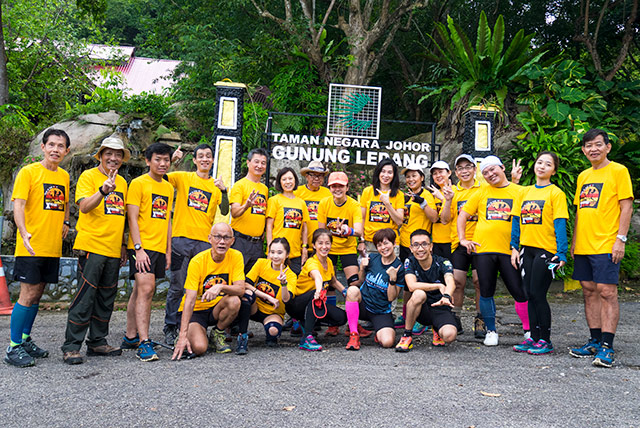
Team members (15 hikers)
KC Leong, Chan How Nean, Ong Soon Aun, Cheng Li, Leong Kee Wai, Sou Kuan Yin, Wey Tyng, Ng Lay Keong, Josephine Lee, Shu-Lin, Rachel Thang, Felicia Hew, Sabrina Lim, Dr Kogulan, Terence Phuah.
Seven rivers/streams to cross before arriving at Kem Kor; after Kem Kor, there is only one stream to cross, that may not get the shoes wet
Distance
(1) Merapoh - peak - Merapoh = 32km x 2 = 64km;
(2) Merapoh - peak - Kuala Tahan (Trans Tahan) = 32km + 55km = 87km.
For journey (1), the returning is mostly downhill; for journey (2), there will be more mountains to ascend, deeper rivers to cross en route to Kuala Tahan. If you have not tried this Gunung Tahan trails, don't ever think of doing Trans Tahan in your first attempt.
Three flavours of Gunung Tahan journey
(1) Merapoh - peak - Merapoh (32km + 32km = 64km);
(2) Trans Tahans (32km + 55km = 87km);
(3) Kuala Tahan - peak - Kuala Tahan (55km + 55km = 110km).
Lunch break after crossing Kuala Luis river
Tahan Personal Porter Services
Each porter would carry a 15kg net weight from the hikers that engage porter service. For a 5D4N hiking and camping trip, the fee is RM1,300 per porter. It is best to share a porter, say, 1/3 share (5kg), or 1/2 share (7.5kg) among hikers. The items for porters to carry must be protected in plastic bags to avoid getting wet; a simple big shopping bag, say, from Ikea or Decathlon would be good to contain all the necessary items when handing over to the porter. The porters would then stuff all these items individually into their own rucksacks.
Located just by a stream with clear water, Kem Kor is the most beautiful campsite throughout the entire journey ... OngSA and NgLK
Backpack Weight
This is a tricky consideration. If one is carrying a few extra kilograms of weight above one's comfortable level, the backpack would weigh one down. Hence, one must seriously test the actual load of the backpack, and for a few continuous days of local training. Allocating 5kg of personal items for porter to carry would ease one's load considerably. I was carrying all stuff myself with a total weight of 15kg. Though I could handle the load, the additional weight from the backpack altered my centre of gravity and threw me off-balance a few times.
At second campsite - Kem Kubang; here, space is limited, and water source is 10 minutes away
4D3N or 5D4N
Most hikers would take the 4D3N journey thereby from Kem Kor to Kem Botak (Day 2 of the hike) is completed within a day. This choice is tough as the distance is 16km, and there is almost 1,200 meters of elevation gain; not forgetting one has to carry the heavy weight of backpacks. Most hikers would take 10 to 12 hours to hike from Kem Kor to Kem Botak. For an additional day (5D4N type), the journey involves extra camping at Kem Kubang, and the journey is less strenuous. With extra day, it is possible to summit from Kem Botak within the same day, enjoying the sunset; and leaving next morning to have direct descent from Kem Botak to Kem Kor.
Good weather and lots of blue sky ... at Bonsai areas (left) Cheng Li, Sabrina, Wey Tyng, Josephine, Shu-Lin, Rachel.
Training
Not all training grounds are the same: for close to Gunung Tahan conditions, one has to train at the stretch between Kem Pacat to False Peak of Gunung Nuang. This part of the terrain is steep and steps are wide, require to use both the arms. While training, one has to carry almost the same amount of intended weight of backpack. With sufficient training, one would enjoy the journey of this Gunung Tahan trails. Another good location for training in Kuala Lumpur is the Mini Tahan Trail in Bukit Dinding (Wangsa Maju area) with the steep slopes for ascent and descent.
Meandering through the trails of Bonsai areas ... ChanHN, Wey Tyng, Cheng Li.
Handling Covid-19 New Norms
Before the group departure on Sat 28 May 2022, all team members must perform RTK Covid-19 self-test on the morning of 28 May, or one day earlier, and published the results in the chat group. Also, five days prior to 28 May, all team members must observe SOP (distancing, masks, etc) to avoid contracting the virus and only developed symptoms after the group had started the journey. Once this process was done, we only have to focus and tackle the tough journey and not be bogged down with the worry that agonize us for the past two years.
Between Bonsai area and Kem Botak ... Wey Tyng, Cheng Li and Josephine
At Kem Botak ... as the name indicates ... it is barren and bright at this campsite
Yours truly, KC Leong, with the Kelty Salida 1-man tent
Continuing the journey from Kem Botak to the peak
Yeah! We finally made it to the peak of Gunung Tahan!
A group photo with the mountain guides, Wan Adham (right) and Rosni Mamat (Left 3)
Vibrant sunset viewed from Kem Botak campsite
A unique view with the clouds hovering so near us
Finally, with the certificate of completion/achievement
A schematic diagram illustrating the entire journey (click at image for bigger view).
Trekking Agent ...
Green Trekkers Sdn Bhd;
Ms Wong; +6016 2898 260 / +6013 3365 628
Posted by KC Leong