Wednesday, November 09, 2016

Mount Siguniang 2nd Sister Peak (2)

ON CAMPING – The team went for three nights of camping in order to scale to the peak of 2nd Sister Peak of Mount Siguniang: the first one at Mu Lo Zi campsite was an acclimatization effort. Camping at an altitude of 3800m, one would know whether one is able to adapt to the altitude without having any symptom of AMS, say, headache. At 8:30 p.m. that evening, the snowing started throughout the night and we were excited with a transform in the landscape overnight – from the colourful of the mountains to the gloomy grey of the winter. After the trial effort, we would then returned to the guesthouse at Rilongzhen for another night's stay.

The first actual camping was staged at Da Hai Zi (Big Lake) 3800m, followed by the final camping which was held at the Erfeng (2nd Sister) base camp 4200m. It was really freezing cold camping out there at the base camp.

(click on the photos for bigger displays)
 Arriving at Muluozi campsite at 4:00 p.m.
 A surprised transformation in the landscape the next morning
 Quite heavy snowing in the night
 The journey continues 
 This good-looking wooden structure is actually the toilet  :-)
 Icing on the cake (horse dun)  :-)
 Another night of camping at DaHaiZi (Big Lake)
Snowing is less there

Do CLICK HERE for Part 3; do CLICK HERE for Part 1.

Do CLICK HERE for all postings/photos on Mount Siguniang ErFeng (2nd Sister Peak) climb.

Posted by KC Leong

Mount Siguniang 2nd Sister Peak (1)

On 1 Nov 2016, only four of the team members – Marcus, Albert, YS and KC – made it to the peak of Mount Siguniang 2nd Sister Peak (ErFeng). Standing at 5,276m in the Sichuan Province, it is only 88 meters lower than Mount Everest Base Camp.

With two nights of camping in freezing cold environment, we started the final ascent from the ErFeng base camp 4,200m at 3:00 a.m. and arrived at the peak at 8:45 a.m. after about 6 hours of tough climb in the freezing cold mountains.

The weather has been very kind to us: it was a fine weather without any snowing other than the snow that was accumulated on the ground days earlier.

The other four team members who could not made it were affected by AMS (mountain sickness) though they have tried very hard in their training and the acclimatisation process.

Team Lead: Eddie of The Guide Proshop, Melawati.

(left): YS Tan, Marcus Ng, Albert Khoo, KC Leong

(click on the photo for bigger display)

Do CLICK HERE for Part 2.


Tuesday, October 04, 2016

Bukit Tabur West

Hiking up Bukit Tabur West on Sunday, 2 October 2016 ... the last time that I went to this quartz ridge was three years ago. These days, we spend most of the time trekking and trail running at the earth-based mountains or hills.

Climbing up this rock-based hill is dangerous and one must hold on dearly to the rock or the rope next to the cliff – and pray that they would never let you down. 

Another name for Bukit Tabur is Klang Gates Quartz Ridge. Luckily there is no gold in the quartz; otherwise, this hill would have been flatten long time ago. The quartz ridges act as a natural dam for the the Klang Gates reservoir, and it is one of the major sources of drinking water for the residents of Klang Valley. 

Do CLICK HERE to view photos courtesy of yours truly (KC Leong).

 Group photo just when the sun rises ... (left) KC Leong, Elsie Liew, LimHY, Ms Lim, Shu-Lin, ChongYF, Lana, Adelyn, Voon Lee, and Dphany.
 All ladies -- Ms Lim, Lana, Dphany, Adelyn, Elsie Liew and Shu-Lin
 Commercial photo shoot up in the hill with the local yow yeng model; I see that the crew spent a lot of effort in carrying up the heavy photographic equipment
 The really happy models (... seeing a Tarzan up in the hill?) 
 Klang Gates reservoir with a view from the ridge above 
 Other than the strong legs, one must have the strong arms too
 Klang valley in the background
 Shu-Lin ... graceful smile amid the fright of descending the cliff below
 A tricky situation in securing a firm spot for landing  
Lover's Rock: Shu-Lin has to cross the rock – tilted downwards – by hugging it firmly 
Alternatively, Lana can even rest comfortably for a little while by leaning against it
A zoom-out view of the ridge
 Brewing coffee and taking a breather
Yeah ... We made it  :-)


Do CLICK HERE for photos of all my previous outings at Bukit Tabur.

Posted by KC Leong

Hiking a Kota Damansara

Trekking at Denai 3 Puteri peak, Kota Damansara on Saturday 1 Oct 2016 ... The group started from Taman Rimba Riang, Seksyen 9 and traversed to Seksyen 10 (KDCF) and returned for a round trip of about 12km.

Note: clicking on the photo will display the full-sized photo.
 At Taman Rimba Riang, Seksyen 9 of Kota Damansara

 At the mid-point of Harmoni and Unity trails
 Proceeding to Denai peak
 Scaling extra height at the peak :-)

 Kuala Lumpur is in that direction  :-)

Arriving at KDCF, Seksyen 10

Posted by KC Leong

Monday, September 19, 2016

Camping in Cameron Highlands

Led by Jimmy Chew, the team lead, the group went for camping at the tea plantation in the high mountains of Cameron Highlands on Friday 16 Sep 2016. The temperature at night was 19 ºC, and the coldest was 17 ºC in the wee hours. Next morning, Jimmy led the group to trek up to Gunung Cantek and Gunung Centuk for a round trip of 3.5 hours.

Do CLICK HERE to view photos courtesy of yours truly (KC Leong).

 The group travel to Cameron Highlands via Sungai Koyan way passing by Bentong and Raub
Many tualang trees along this Sg Koyan highway. Bees construct beehives on the branches and the orang asli has to climb the tall trees to harvest the honey.
Passing by the Ulu Jelai hydroelectric power station. Water comes from three rivers: Sungai Bertam, Sungai Telom and Sungai Lemoi
 Heavy load of backpack -- each is between 15kg to 20kg ... (left) Alan Ng, Jimmy Chew, KC Leong, CJ; not in photo: Khoo.
 Cheers! Having some red wine in the cold mountains; temperature is 19 ºC 
 Spectacular sunrise the next morning
 Topdressing in progress (aerial spraying of fertilizer)
 Serene and tranquil tea valley
 MNS (Malaysian Nature Society) chalet which is now closed and not in operation. Trekking up Gunung Cantek and Gunung Cenduk is from the trail behind MNS.
 Trekking along the trails of the tea plants
 Gunung Cantek peak -- there is no view at this peak
Gunung Cenduk peak -- there is no view here either 

Posted by KC Leong

Sunday, September 11, 2016

Kemensah Trail Recce

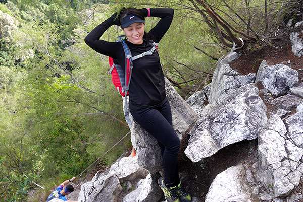
Only three of us (Jimmy, Alan and KC) went for a recce trekking trip into the Kemensah - Congkak trail on Saturday, 10 Sept 2016. Most of the time, the trail was overgrown with bushes and thorny weeds; after the stream crossing, the trail was not visible in the rainforest. Jimmy has to rely on his Orion GPS unit and the topographic map to determine the actual location and the destination. At one area, we were trekking along a ridge but headed towards a dense bamboo bushes which we could not cut a trail ahead. 

In adhering to the cut-off time, we decided to abort the mission and return to the trail head. We shall re-strategize, get more choppers and try again later. 

On the way out, we detoured to Kubang Gajah waterfall (or Sofea Jane waterfall) for taking a breather. We also met a group of ATV (all terrains vehicle) enthusiasts who were going into the waterfall.

Do CLICK HERE to view photos courtesy of yours truly (KC Leong).
The trail where we are heading is near to Jimmy. Direction to Kubang Gajah waterfall is on the right of the signboard.
A waterfall next to the trail 
 Trail? there is no trail. We have to use parang to cut out a trail to move ahead
 Most of the time, the trails are encroached with overgrown bushes and thorny weeds
 Taking a breather at Kubang Gajah waterfall ... KC Leong, Jimmy and Alan
 Kubang Gajah waterfall (aka Sofea Jane waterfall)
On the way out, we met a group of ATV enthusiasts having fun in the outing 

Getting There:

Park your car by the roadside in front of Institut Budaya Baru Malaysia. 
Google Maps: Pertubuhan Pendidikan Anak Yatim Selangor.

The trailhead is 100 meters before the Institut Budaya Baru Malaysia.

Trailhead GPS coordinates: 
3°12'57.8"N 101°47'21.6"E
3.216068, 101.789337

Before you decided to visit the Kemensah trail or the waterfalls, do give Encik Shidee a call in ensuring your car and your safety (handphone: 012- 644 1226 or 019-611 7002). 

Posted by KC Leong